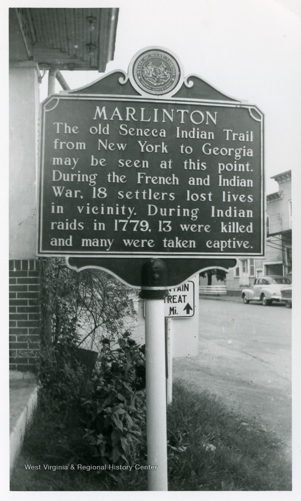

The Seneca Trail is a historic Native American trail that ran through Pocahontas County, West Virginia. It was a major thoroughfare during the time the Iroquois Confederation was consolidating its power in eastern North America. The trail was named for the Senecas, one of the Six Nations making up the great Indian empire.
The Seneca Trail entered Pocahontas County from the north, near the present-day town of Hillsboro. It followed the Greenbrier River south to the vicinity of White Sulphur Springs. From there, it ascended to the vicinity of Droop Mountain and then followed Anthony Creek down to the Greenbrier River near the present Pocahontas-Greenbrier County line.
The Seneca Trail was used by Native Americans for centuries as a trade route and a path for travel. It was also used by European settlers during the colonial period. In the 1760s, the British government established the Proclamation Line of 1763, which prohibited settlement west of the Appalachian Mountains. The Seneca Trail ran along the western side of the Proclamation Line, and it became a major route for illegal settlement.
The Seneca Trail continued to be used by Native Americans and settlers throughout the 19th century. However, it gradually fell out of use as new roads and railroads were built. Today, the Seneca Trail is still visible in some places, but it is no longer used as a major route of travel.
There are a few historical markers along the Seneca Trail in Pocahontas County. One marker is located near the town of Marlinton, and another is located near the Greenbrier River. These markers provide information about the history of the trail and its importance to Native Americans and settlers.
The Seneca Trail is a significant part of the history of Pocahontas County. It was a major route for travel and trade for centuries, and it played an important role in the settlement of the region. Today, the Seneca Trail is a reminder of the rich history of Pocahontas County and the Native Americans who once called it home.

.png)
.png)
No comments:
Post a Comment